search
Turkey ferry map
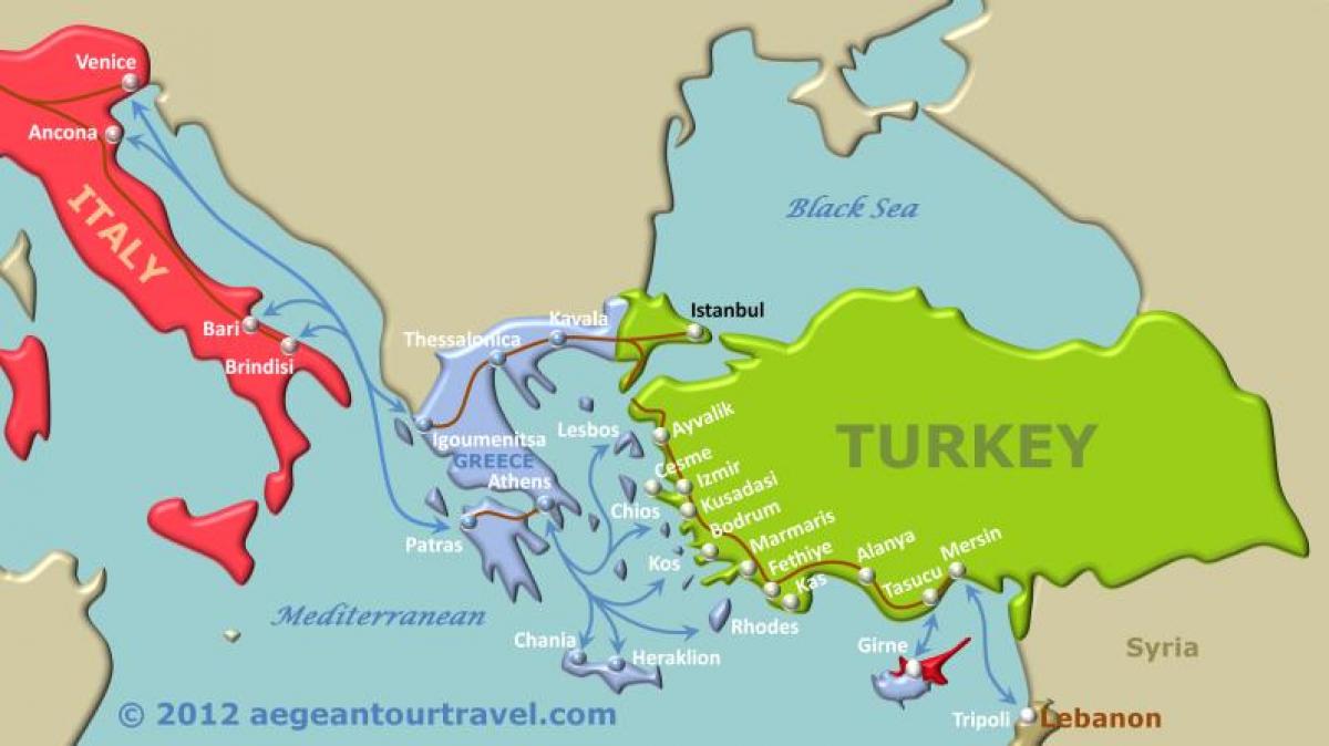
Map of Turkey ferry. Turkey ferry map (Western Asia - Asia) to print. Turkey ferry map (Western Asia - Asia) to download. Turkey domestic ferry network is confined to İstanbul and the Sea of Marmara. Şehir Hatları (w sehirhatlari.com) operates ferries along the Bosphorus, between the European and Asian sides of the same strait, and to the Princess Islands. Longer runs across the Sea of Marmara to Yalova (for Termal & İznik), Mudanya (for Bursa) and Bandırma (for the Aegean coast) are the preserve of İstanbul Deniz Ötobüsleri (w ido.com.tr) sea-buses as its shown in Turkey ferry map. Any of the trans-Marmara car-ferry links save time compared to the dreary, circuitous road journey, but are relatively expensive with a vehicle. Private companies offer services from the Mediterranean town of Taşucu to Girne in Northern Cyprus year-round, and catamarans run from the resort of Alanya in the summer months.
Fast, sleek İDO catamaran car ferries zoom across the Sea of Marmara from Istanbul Yenikapı Feribot Terminalı to Güzelyalı (for Bursa), to Yalova (for İznik and Bursa), and to Bandırma (for Çanakkale and İzmir) as its mentioned in Turkey ferry map. Car ferries cross the ancient Hellespont (Çanakkale Boğazı) between Eceabat on the Gallipoli Peninsula and Çanakkale, and Gelibolu and Lapseki, with some additional service between Çanakkale and Kilitbahir. Currently there are no direct ferries between Çeşme (the port west of İzmir), and Brindisi and Ancona in Italy, but you can go via Greece. Ferries also cross to Turkish Cyprus from several cities along Turkey Mediterranean coast, including Alanya, Mersin and Taşucu (Silifke).


