search
Turkey region map
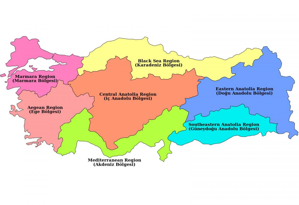
Map of Turkey region. Turkey region map (Western Asia - Asia) to print. Turkey region map (Western Asia - Asia) to download. The first Geography Congress held in Ankara between 6-21 June 1941 divided Turkey into seven regions after long discussions and work. These geographical regions were separated according to their climate, location, fauna and the flora, human habitat, agricultural diversities, transportation, topography and so on. At the end, 4 side regions and 3 inner regions were named according to their neighborhood to the four seas Turkey and positions in Anatolia as its shown in Turkey region map. Most of the cities borders are within the territory of a single region, but sometimes can be within two, even three regions (such as Sivas, Afyon, Kahramanmaras). Sitting in north-west Turkey, the Marmara region includes Istanbul, the country largest, most populated and busiest city. Despite being home to Turkey most populated city, do not assume the Marmara region is all about an urban lifestyle because the Bolu Province promotes natural living and Mother Nature.
With the longest coastline, Aegean Region garners its name from the Aegean Sea. Three central provinces as its mentioned in Turkey region map; Aydin, Izmir and Mugla stand out as strong performers for travellers and expats living and buying property in Turkey. Notable districts include Kusadasi that does a roaring trade from cruise ship liners docking in to see the nearby ancient ruins of Ephesus city, another UNESCO World Heritage Site and top visited attraction. Covering the entire southern coast, the Mediterranean region is Turkey success story. Excelling in all areas of life, it makes a roaring trade in tourism, foreign real estate, education, and general business. Backed by the Taurus mountain range, during summer, locals and holidaymakers flock to coastal regions to bask on sandy beaches fronted by the gorgeous blue Mediterranean Sea.
Covering the entire north coast, the Black Sea region is Turkey rising star. For decades, while the south and west of the country developed thriving tourism and real estate industries, the Black Sea stayed off the grid. In the heart of the country, the central Anatolian region has many attributes to boast about. First, the government reigns supreme from Ankara, the capital. Secondly many Turks highly respect the Anitkabir, holding the tomb of Mustafa Kemal Ataturk who founded the Republic. Consisting of most of eastern Turkey, Eastern Anatolian region is not popular on the mainstream foreign travel industry, yet over the last decade, Turks have taken a more substantial interest in exploring the flat plains bordering Iraq, Iran, Azerbaijan, Armenian and Georgia. Covering just over 59,000 square kilometres, in history, the southern Anatolian region as you can see in Turkey region map sat on the edge of Mesopotamia, of which some say was the birthplace of civilisations.


