search
Turkey highway map
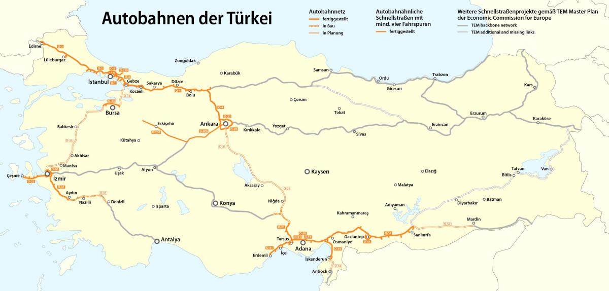
Map of Turkey highway. Turkey highway map (Western Asia - Asia) to print. Turkey highway map (Western Asia - Asia) to download. State roads in Turkey are highways of primary importance connecting provincial centers, sea, seaports, airports and railway stations to each other. Provincial roads are highways of secondary importance linking districts within a province to each other , the provincial center, the districts in the neighboring provinces, the state roads, railway stations, seaports, and airports. General Directorate of Highways started the implementation of a highway upgrading program in 2003 involving the upgrading of existing single carriageway into dual carriageway. In 2010, Total budget of Turkish Highway amounted to 6.3 Billion Euro as its shown in Turkey highway map. Turkish Highways considers the realization of the some motorway projects by PPP financing by the end of 2023 to meet the road transport demand of the overall economy.
All of Turkey toll highways and bridges have been converted to the High-Speed Toll System (Hızlı Geçiş Sistemi, "Fast Transit System," or HGS) to increase the speed of traffic flow as its mentioned in Turkey highway map. This means that you cannot pay highway or bridge tolls with cash or credit card. Your vehicle, whether private or rented, must have an electronic toll-payment device. HGS = Hızlı Geçiş Sistemi, "High-Speed Passage System:" The high-speed system allows you to pass at highway speed through the toll area. Besides the toll otoyols, Turkey's non-toll highway system has been substantially upgraded in recent years, with safer, faster 4-lane dual-carriageway highways replacing 2- and 3-lane roads.


