search
Southeast Turkey map
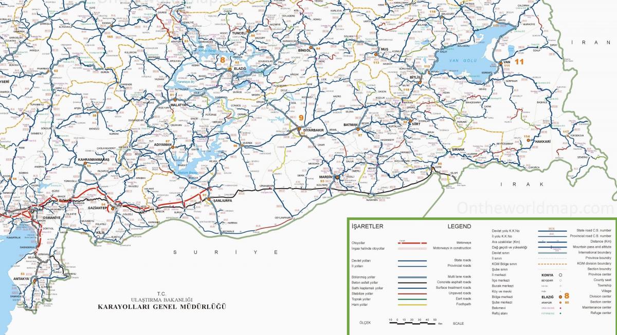
Map of southeast Turkey. Southeast Turkey map (Western Asia - Asia) to print. Southeast Turkey map (Western Asia - Asia) to download. Southeast Turkey is the northern extension of the Syrian plain (map), which means it is hot and flat. Unlike most of Eastern Turkey, the southeast is not mountainous, but rather an arid plateau at around 600 meters (2000 feet) elevation as its shown in southeast Turkey map. The region is more or less bounded by those great historic rivers, the Tigris (Dicle)to the east and the Euphrates (Fırat) to the west (maps). Many of the people here are Turkish citizens of Kurdish descent. The region was a crossroads of civilizations in Biblical times, and even earlier. The Patriarch Abraham lived for a time in Harran, south of Şanlıurfa. Urfa, as it’s commonly called, has a rock promontory at its center crowned with an ancient fortress. At its foot is a sacred pool and the reputed birthplace of the Patriarch Abraham. It’s a popular place of pilgrimage for Muslims, with a fascinating bazaar and a few fine old buildings.
The best times to visit southeast Turkey are spring (March, April, May) and autumn (October–November). In July, August and September the sun blazes, and there is rarely a cloud. In winter it can be chilly. With its mighty black basalt walls looming over the fertile banks of the Tigris, Diyarbakır as its mentioned in southeast Turkey map is dramatic, not to mention historic. The walled city still retains much of its medieval air, not to mention its street pattern. Many citizens are Kurdish. Business and finance capital of the southeast, Antep is known for its pistachios and the baklava made from them. Although it’s a very old city, only a few bits of its antiquity remain. The oldest religious site known to humans, an 11,000-year-old temple complex, was discovered near Şanlıurfa. If you have any interest in history or archeology, you simply have to visit Göbekli Tepe. Archeologists say “It changes everything.”
An astounding sight as you can see in southeast Turkey map: a warren of beehive-like mud houses rising from the Syrian plain. Harran looks like it has been here forever—and it has; ever since the Book of Genesis, at least. Yet another ancient town, now grown into a modern citywith little to show for its long past. Kahramanmaraş (KAHH-rah-MAHN-mah-RAHSH, or simply Maraş), has decent hotels if you need a place to stop. It is famous for its ice cream, so thick with binder that you can hang it on a hook for display. Perched at the edge of a plateau looking out over the Syrian plain, Mardin has several impressive oldish buildings (1300s and later), but the Assyrian monasteries around Midyat in the Tur Abdin region to the east are far older, some dating from the 5th century. Because it is up in the mountains rather than on the plain, Nemrut Dağı, Adıyaman, Kâhta and Malatya belong more to Eastern Turkey than to the Southeast.


