search
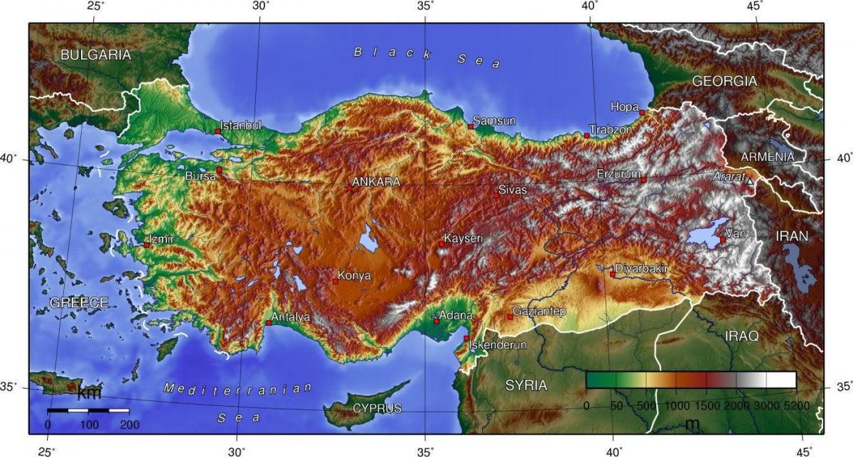
Turkey elevation map
Map of Turkey elevation. Turkey elevation map (Western Asia - Asia) to print. Turkey elevation map (Western Asia - Asia) to download. Mount Ararat (see below details on names) is a snow-capped, dormant volcanic cone in Turkey. It has two peaks: Greater Ararat (the highest peak in Turkey, and the entire Armenian plateau with an elevation of 5,137 m/16,854 ft) and Lesser Ararat (with an elevation of 3,896 m/12,782 ft) as its shown in Turkey elevation map. The Ararat massif is about 40 km (25 mi) in diameter. The Iran-Turkey boundary skirts east of Lesser Ararat, the lower peak of the Ararat massif. It was in this area that, by the Tehran Convention of 1932, a border change was made in Turkey favour, allowing it to occupy the eastern flank of Lesser Ararat. Mount Ararat in Judeo-Christian tradition is associated with the "Mountains of Ararat" where, according to the book of Genesis, Noah's ark came to rest. It also plays a significant role in Armenian culture and irredentism.
Turkey mean elevation as its mentioned in Turkey elevation map is: 1,132 m. Its lowest elevation point is the Mediterranean Sea 0 m while its highest elevatoion point is the Mount Ararat 5,137 m. Examination of Turkey topographic structure on a physical map of the world shows clearly the country high elevation in comparison to its neighbors, half of the land area being higher than 1000 meters (3281 feet) and two thirds higher than 800 meters.


