search
Turkey geographic map
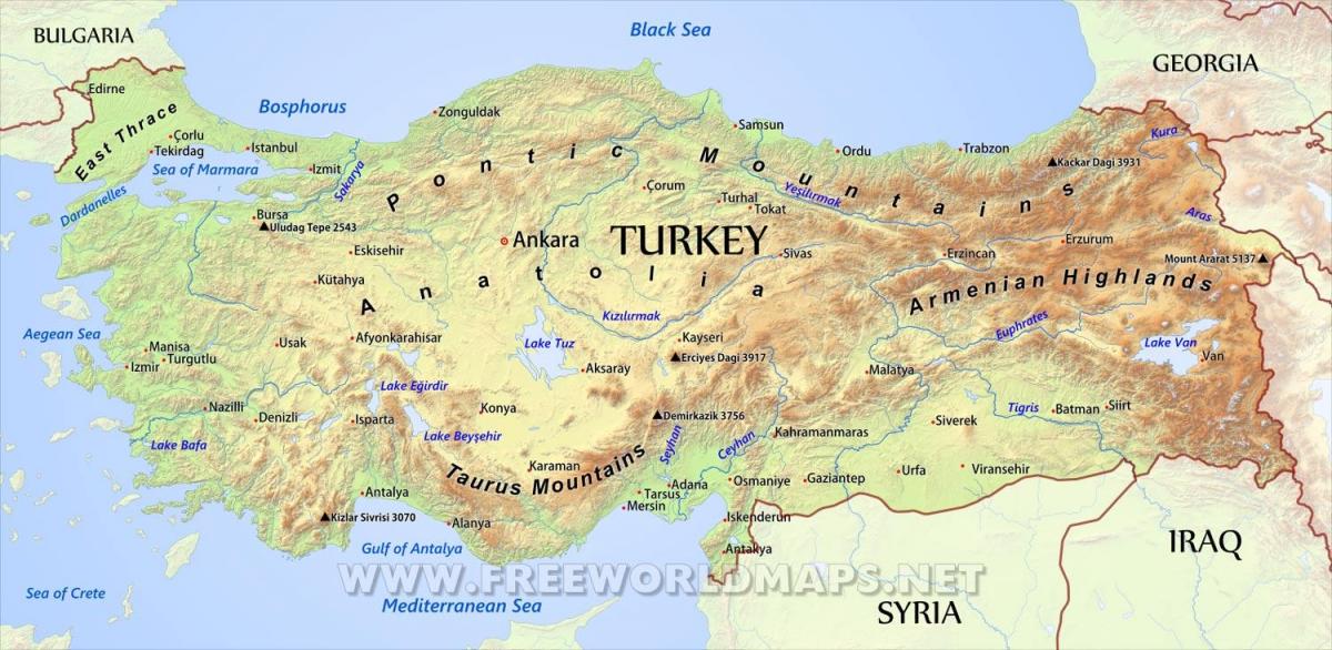
Turkey geographical map. Turkey geographic map (Western Asia - Asia) to print. Turkey geographic map (Western Asia - Asia) to download. Turkey is situated in Anatolia and the Balkans, bordering the Black Sea, between Bulgaria and Georgia, and bordering the Aegean Sea and the Mediterranean Sea, between Greece and Syria. The geographic coordinates of the country lie at: 39°00′N 35°00′E / 39°N 35°E. The area of Turkey as its shown in Turkey geographic map is 783,562 km2 (302,535 sq mi); land: 770,760 km2 (297,592 sq mi), water: 9,820 km2 (3,792 sq mi).
The 1st Geography Congress, held in Ankara between 6–21 June 1941, divided Turkey into seven regions after long discussions and work as its mentioned in Turkey geographic map. These geographical regions were separated according to their climate, location, flora and fauna, human habitat, agricultural diversities, transportation, topography and so on. At the end, 4 side regions and 3 inner regions were named according to their neighborhood to the four seas surrounding Turkey and positions in Anatolia.
Turkey is one of the most earthquake prone areas on Earth and has suffered from 13 earthquakes in the past 70 years as you can see in Turkey geographic map. The North Anatolian Fault extends hundreds of miles from the Sea of Marmara in the western part of the country to the Eastern Anatolian Highlands. The fault moves back and forth about 8 inches (20 centimeters) a year. Turkey is separated into seven geographical regions, which are, in order of size: Eastern Anatolia, Central Anatolia, Black Sea, Mediterranean, Aegean, Marmara and Southeastern Anatolia.


